Geospotting
A mobile game somewhere between geocaching, GeoGuessr and Pokemon Go. One that requires players to walk around in a real city. Békéscsaba, Hungary to be exact.
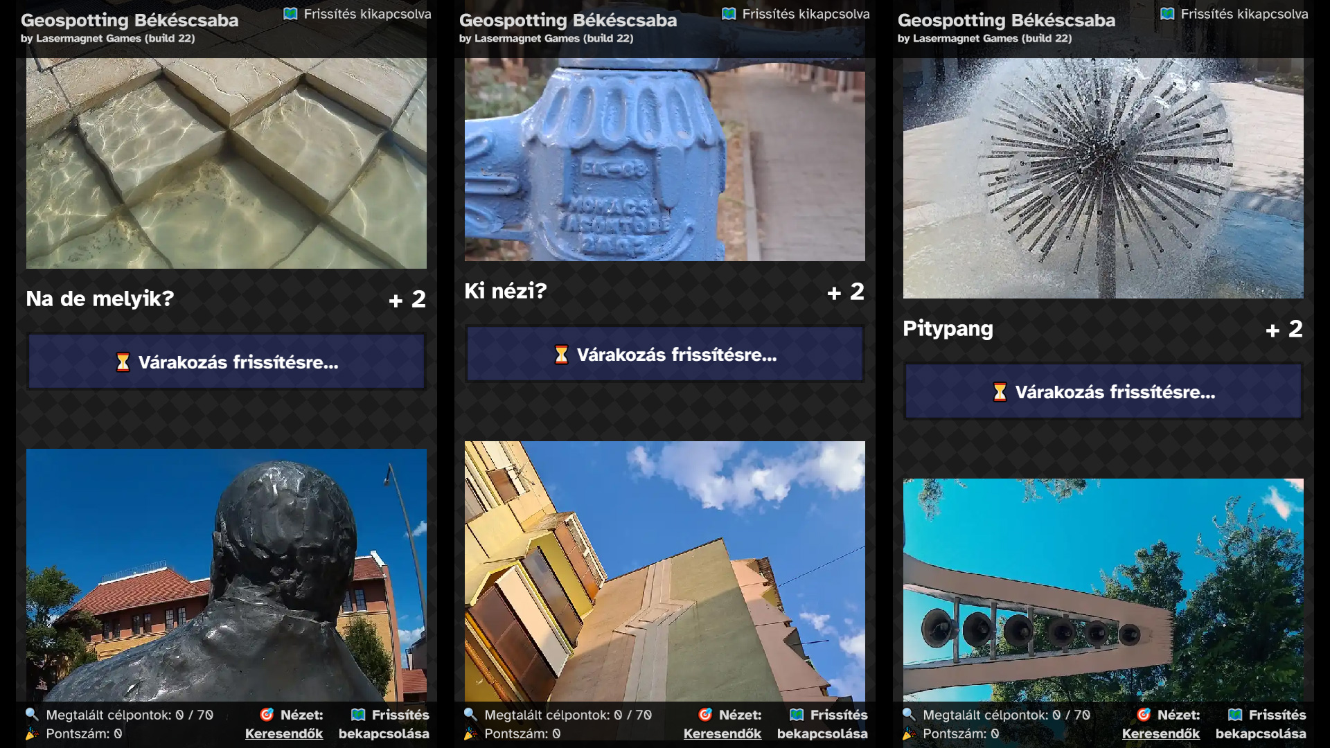
Back in the 2010s I was co-organizer of number of community events aimed at secondary schoolers in my hometown Békéscsaba. In 2017 an event called Rongyoló (hard to translate, but the pun was the inclusion of the word "yolo" in it), a student organized mini festival of sorts with live concerts and various activities across a few days. One of those activities was a game I designed, where small teams had 90 minutes to frantically run around and find real locations in the city based on clues (semi-cryptic titles and photos taken at the target location). Every team had to use an Android app (made with Cordova) running on their phones to view the clues, then they had to plan their route and then finally go to the locations. The app showed the current distance of each target (also a clue in itself) and when a team managed to get within 15 meters of one, a "Found it!" button popped up, which they could press to get points for finding the right place. They also had the option to get an extra clue for hard to find targets by pressing a hint button, but this also meant that they'll only get half of the original point reward for that target if they manage to find it.
Back then it was less common for every secondary schooler to have mobile Internet connectivity on their phones, so I designed the game to work 100% offline after installation, every asset was included in the initial download. When the 90 minute timer expired, the app switched to an end-game mode, so it wasn't possible to collect more points and every team had to head back to HQ. In this mode the app showed a QR code containing an encrypted array of found targets and their point values, plus the maximum velocity recorded during the hunt (it was forbidden to use motorized vehicles, so I figured why not add this little telemetry). I used a separate app to read & decrypt the contents of the QR codes, then I compiled the end results. Top teams got some small prizes and of course, bragging rights. It was fun to make and according to the participants, fun to play.
In 2022 I wanted to resurrect the project and rewrote most of the player app using Onsen UI (I figured it should be a PWA instead of an app, so iPhone users can participate as well), but then procrastination got the best of me.
Then in the spring of 2024 the idea resurfaced and got some traction after I presented it for a local youth club and we decided to make another one-off game event in September 2024. I changed the name to "Geospotting" then rewrote the app in Construct 3 (of course) in August, removed targets that weren't there anymore (hey, it's been 7 years) and with some help of a co-organizer of the event also added some more too. The final version contained 70 targets with one photo and one text clue each, and we allowed bigger teams to participate during the 2 hour "hunt". Teams could also split up this time and use more then one phone, so I wrote a little app that summarized the data by team so it wasn't possible to get points if a team found a clue more then once.
After the event I made a public version of Geospotting, which you can find on geospotting.net. Again, playing it requires visiting my lovely hometown of Békéscsaba, Hungary, but on the off chance that's manageable for you, by all means give the game a go. And if not, you can still look at the picture clues :)

